Sunday, December 18, 2016

Many Westerns shot at Arizona's Apacheland Movie Ranch

Elvis Chapel
At one time Apacheland Movie Ranch had dreams of becoming the Western movie capital of the world. That dream went up in smoke, though a respectable number of Western movies and TV shows were filmed here in the decades before fire destroyed the movie set.

 Apacheland was started in 1959 on Apache Trail Road, a scenic byway that runs through the Superstition Mountains east of Phoenix, Arizona.

Apacheland suffered a fire in 1969, but the one that pretty much destroyed the movie set happened on Valentine’s Day in 2004.

When the blaze ended, the only buildings left were the chapel, the barn/stable and the gallows. They were moved 10 miles down the road to the Superstition Mountain Museum.

The chapel is known as the Elvis Chapel because it was featured in Charro!, a movie starring Elvis Presley that was made here. Inside, on the altar, you’ll find a life-size statue of Elvis. The chapel is a wedding venue; a docent says many couples choose to be married standing next to Elvis, though he can be moved aside for the ceremony.

Aduie Murphy Barn
The barn is known as the Audie Murphy Barn because of a shootout scene filmed for Arizona Raiders. Inside, you’ll find pictures of actors and actresses who starred in movies and TV shows filmed here. There’s also the buggy that Doc drove in Gunsmoke.

Besides Elvis and Audie Murphy, the list includes Steve McQueen, Ronald Reagan, John Wayne, Clint Walker, Stella Stevens, Marty Robbins and Ida Lupino.

Stars at  Apacheland
Television productions include Have Gun Will Travel, Wagon Train, Gunsnoke, and Wanted: Dead or Alive.

Movies include Blood on the Arrow, Ballad of Cable Hogue, The Hunted and Broken Land.

The museum is open daily from 9 a.m. to 4 p.m., though it does close on major holidays.

To get there take the Idaho Road exit off Highway 60 at Apache Junction. Stay on this road until you get to Highway 88/Apache Trail Road. The museum is about three miles from the intersection.

Thursday, October 27, 2016

Arizona's Interstate 19 stands apart from other freeways

Interstate 19 sign
        Interstate 19 that connects Tucson with Nogales at the border with Mexico isn’t your normal interstate freeway.

For starters, I-19 is the fourth shortest double-digit freeway in the interstate system in the Lower 48 states, running just over 63 miles long.

Secondly, the distances on “mile” posts and freeway signs use the metric system, so they’re in meters and kilometers rather than miles. When the freeway was built, the United States was considering adopting the metric system and signs have just remained that way over the decades. It’s the only interstate in the system with metric signage.

I-19 follows the route of U.S. Highway 89, which once stretched down the United States, connecting the Canadian and Mexican borders.

Saturday, September 17, 2016

Arizona's spectacular sunsets


           Arizona sunsets may be one of the greatest shows on earth.  As day melts into night, the sky is lit up in brilliant oranges, reds and yellows.

Why? The explanation has to do with physics. I am science-challenged and don’t really fully understand the concept, but it goes something like this: The blue and violet colors in the sky’s color palette are short wavelengths, while red, orange and yellow are long wavelengths. As the earth turns, the wavelengths must travel farther to reach the same spot. The short wavelengths aren’t strong enough to travel that far through particles, such as nitrogen, oxygen and dust, in the earth’s atmosphere.  So they’re blocked out, and only the long wavelengths make it through. Clouds and the desert also have a hand in helping Mother Nature create these spectacular light shows.

Do we really need to understand the science behind Arizona’s gorgeous sunsets to appreciate them? Not really. All we need to do is enjoy them!


Saturday, August 20, 2016

Mining is important industry in Globe, Arizona, then and now

Globe, Arizona
Globe, Arizona, was founded in the mid 1870s as a mining town. It supposedly got its name from a globe-shaped piece of silver found there.

Silver was first discovered by prospectors in 1875 on the nearby San Carlos Apache Reservation. The vein was not a very good one, but then copper was found and the rest, as they say, is history. There are four copper mines and associated facilities in the Globe area today. Back then, the Old Dominion Copper Mine was one of the richest in the world. It closed in 1931, but you can learn more about it at the Old Dominion Historic Mine Park.

Globe was a rough and tumble frontier town during its early years. It had the usual lynchings, gunfights and stagecoach robberies, and was raided by its Apache neighbors.

Old Globe is located on a hill, with the new city stretching out before it. The historic district is on the National Register of Historic Places. Many historic buildings remain standing, including the Woolworth’s building, which was the last Woolworths west of the Mississippi River to close. The city’s high school, built in 1010, is the oldest high school in the state that it still being used by its original occupant. Another cool building is the Art Deco Globe Theatre with copper columns; the theatre has been restored following a fire in 2006.

Globe is the capital of Gila County.  Surrounded by mountains and Tonto National Forest, it is located on Highway 60 less than 90 miles west of Phoenix.


Friday, July 22, 2016

Globe, Arizona, park features mining heritage, fitness trails

Raw copper ore
The old Dominion Historic Mine Park serves two purposes. One is to educate the public about the importance of mining in the Globe, Arizona, area. The other is to provide a series of fitness trails through the old mine site.

From 1880 to 1931, the Old Dominion Mine was a powerhouse in Globe’s copper mining industry, producing more than 765 million pounds of copper.

You’ll find pieces of old mining equipment scattered around the mine site. At the entrance, you’ll see a copper-studded boulder as well as a display of various types of rocks, each identified with a placard on the chain link fence.

Mining equipment on display
The park has trails for all levels of fitness. Non-motorized bicycles are allowed as well as wheelchairs and strollers.  The trails are not paved, just gravel and dirt. They are named for original mine claim owners at this location.

If you’re visiting on a hot summer day, be sure to have water with you. As you walk the trails, be on the lookout for rattlesnakes; I heard one in the bushes when we were there, but did not see it.

The park is open daily from dawn to dusk. Operated by the City of Globe, there are restrooms at the entrance; picnic facilities are available.

The park is located on Highway 60 in Globe. Turn on Murray Street by DeMarco’s Pizza and go up the hill.


.


Friday, July 8, 2016

Tubac, Arizona, building centers around art

Tubac Art Center
Tubac, Arizona, may have only about 2,000 residents, but it’s got a burgeoning art colony with more than 100 galleries, studios and boutiques. It’s no surprise, therefore, that it has its own art center.

The Tubac Art Center is operated by the Santa Cruz Valley Artists Association, which was founded with 80 members in the 1960s. Today, it has more than 850 members, only about a third who are from Tubac.

The center offers changing exhibits by both local and nationally known artists. It has room for art classes, workshops and other special events. A spring exhibit features work by local high school students.

The center is located in an adobe building at 9 Plaza Road. It is open daily. Admission is free.

Monday, June 27, 2016

Globe, Arizona, park showcases ancient Indian ruins

Besh Ba Gowah Archeological Park
Besh Ba Gowah is one of the more significant archeological finds of the Desert Southwest. The ruins were constructed by Native Americans at least eight centuries ago.

The people who built the 164-room stone structure were originally known as Hohokams, the same tribe that built an amazing irrigation system in 300 BC in Casa Grande, Arizona. The Globe, Arizona, Hohokams assimilated other native cultures into theirs so much so they lost their Hohokam identify. For lack of anything better, archeologists called them Salados. The Salados traded far and wide, often with tribes as far as a thousand miles away.  A collection of the Pacific Coast seashells they traded for can be seen at the on-site museum.

The Salados built a warren of rooms and buildings; some of the buildings were two stories high. Two of these buildings have been restored. Stones for the complex were hauled from nearby Pinal Creek. Except for the restored buildings, the remaining walls aren’t very high. Doorways are only a couple of feet high. Some of the rooms are small, while others are bigger. They were used as living quarters and for storage, among other uses. Today, some of the rooms are filled with wildflowers and cactus, rather than home furnishings, some of which you can see at the museum.

Globe was founded around 1875 as a mining camp. This resulted in the Apaches giving the place the name of Besh Ba Gowah, which translates as “metal camp.”

The Salados disappeared from Besh Ba Gowah around 1400 AD, about 50 years before the Hohokams disappeared from Casa Grande.

The on-site museum is small, but excellent. A 140minute video provides an introduction to the site. The museum displays artifacts, such as highly decorative pottery, found in the ruins. It also has a replica of what the ruins might have looked like when they were used by the Salados.

The City of Globe operates the museum and archeological park today. The museum is open daily from 9 a.m. to 4:30 p.m.; it is closed Thanksgiving, Christmas and New Year’s Day.  It’s located at 1324 South Jesse Hayes Road. Turn onto Saguaro Drive from Highway 60. Stay on the winding round for about 1.4 miles, then make a right turn onto Jesse Hays Road and follow the signs. There’s a city park with picnic facilities across the parking lot from the ruins.
 
See more pictures of Besh Ba Gowah on mty YouTube channel. https://youtu.be/8idhAn-17Hg.
 
Besh Ba Gowah ruins as they might have looked originally

Sunday, June 19, 2016

Be prepared for driving emergencies in the desert

Sonoran Desert
As my husband is fond of saying, southern Arizona has only five temperatures: hot, hotter, hottest, hot as hell and hotter than hell.

If you’re going to be spending any time here, even it’s just mostly driving through, you need to be prepared, especially in the summer. You never know when emergencies will crop up, which is something we learned the hard way.

We were traveling across the Sonoran Desert on Interstate 8 from Yuma to Tucson in late July one time. It was 125 degrees in the shade, only there was no shade on the freeway. Our pick-up broke down, shutting all electrical systems down, leaving us with no air conditioning or the ability to put the power windows down for any breeze that might come along. Since we were barely on the freeway shoulder, we could only open doors on the passenger side.

Luckily our cell phones were charged and we could get service.  When we called for roadside assistance, we were told it would be about two hours before help arrived almost 40 miles from the nearest town. It was so hot, we were both sweating so profusely, you could wring liquid out of our clothes. We had a cooler full of bottled water, so we could replace what we lost, but we couldn’t get our little dog to drink any. He gasped furiously for air, then collapsed, so still we thought we’d lost him.

More than an hour into our wait, a state patrolman stopped and insisted on taking us to a gas station four miles away where we could wait in shade for the tow truck. I shudder to think what would have happened to us if the patrolman hadn’t come along.

So what did we learn from this?

  • Make sure your car is in good working condition if you’re traveling through the desert in the heat of the day.  You can’t anticipate breakdowns, but if you know there’s something wrong with your vehicle, even if it seems minor, get it fixed before you start cross the desert. The repair shop said the part that broke, disabling our truck, rarely did so, but the breakdown turned a 3 -1/2 trip into one that lasted almost eight hours.
  • Make sure your cell phone is charged. My husband and I purposely use different cell service providers, just in case one of us can’t get service, the other one probably can.
  • Make sure you have a good roadside assistance plan and call for help immediately.
  • Make sure you have lots of bottled water, preferably in a cooler, with you. And drink lots of it. Becoming dehydrated will only add to your problems. Even if we’re just going to Tucson, 45 miles from where we live now, we’ll take a cooler containing 6-8 bottles of water with us.


Tuesday, June 7, 2016

Fort Apache: from 19th century fort to school

First Officer's Quarters
If you’re a fan of John Ford’s 1948 Western, Fort Apache or the 1950s kids; TV series, The Adventures of Rin Tin Tin, you’re in for a shock when you visit the real thing in the White Mountains of central Arizona.

Nothing remains of the original fort, established in 1870 as Camp Ord. Indeed, the oldest building in the complex is the First Officer’s Quarters, constructed in 1893. The ranch-style log cabin is now a museum devoted to the fort’s history. It was abandoned by the U.S. Army in 1922 and was turned into a boarding school for Indian children. A school still operates on the site today, though children are now bused in.

Plaques in front of the buildings explain what the buildings were used for in the days when the complex was a fort and boarding school.  The fort complex is now an historic site administered by the White Mountain Apaches.

The camp was renamed Camp Apache in 1871 to honor the Apache tribe. It was established to protect the White Mountain Reservation and the Indian agency. But soldiers soon found themselves embroiled in war for many years with these very same Indians. The unrest worsened in the next few years, heating up in 1876 when the government moved the Chiricahua Indians from Fort Bowie in southeastern Arizona to the San Carlos Reservation that adjoined the White Mountain Reservation.

Monument
War with the Indians went on for 15 years, finally ending with the capture of Geronimo in 1886. A monument to the soldiers killed at the August 30, 1881, battle of Cibicu Creek stands in the yard surrounding the First Officer’s Quarters.

Admission to the historic site  is charged; the fee also includes admission to the tribe’s nearby cultural center and the Kinibisha ruins.  

The cultural center is known as Nohwike' Bagowa or House of Our Footprints. It’s small but does a good job of explaining the history of the White Mountain Apaches. A video plays inside a wickiup, but the narrative is only in the tribe’s native language with English subtitles.


Fort Apache is located on Highway 73, a 24-mile detour off Highway 60/77 that connects Globe and Showlow.  Casual travelers may not think the detour is worth it. Fort Apache will appeal most to visitors with a strong interest in Native Americans and the Indian wars of the Old West.


Monday, May 23, 2016

Arizona's Salt River Canyon: awesome

Highway through Salt River Canyon
Arizona’s Salt River Canyon isn’t as deep, wide or long as its cousin to the north, the Grand Canyon, but it still is mighty impressive.

The Salt River Canyon is awesome! The views are spectacular. The canyon ranges in depth from 2,200 to more than 4,000 feet deep. The canyon is located in the White Mountains of central Arizona, about midway between Globe and Showlow on the very scenic Highway 60/77.

As the car drives, it’s nine miles from the top of one rim to the top on the other side. As the crow flies, it’s a heckuva lot shorter because they don’t have to drive down/up steep switchbacks with tight curves. Nor will they want to stop in mid-air to admire the view, though motorists will want to stop at some of the many viewpoints on the route.  The road has a 6 percent grade, so you’ll want to make sure your vehicle brakes are in good working order.

View from the pedestrian bridge
There’s a rest area at the bottom of the hill, with plenty of parking for those who want to do more than just use the restrooms (there’s no water available to wash hands).  A pedestrian bridge runs parallel to the vehicular bridge crossing the Salt River. Steps lead down to the river and trails.

The Salt River Canyon is part of a wilderness area administered by the U.S. Forest Service. The Forest Service says about 200 species of wildlife can be seen in the wilderness area; highway signs caution drivers to watch out for deer and elk.

Salt River Canyon

Thursday, May 12, 2016

American Flag Ranch: mine, post office, cattle ranch, museum

American Flag Ranch
territorial post office
The American Flag Ranch has a rich, varied history.  Located on a quiet road a few miles outside of Oracle, Arizona, it was founded in 1877 as the American Flag Mine.

The mine attracted hundreds of miners, not just to work at it, but alsothose who wanted to get rich with their own mines. This list included Buffalo Bill Cody who had a mine a couple of miles away at Campo Bonito.

A post office was established in 1880, back when Arizona was still a territory, Named the American Flag Post Office, it was located in a ranch building that is now the oldest territorial post office still standing in Arizona. The building was named to the National Register of Historical Buildings in 1979.

The mine eventually closed, and its founder, Isaac Lorraine, turned his property into a cattle ranch.

Owned today by the Oracle Historical Society, the ranch is now a museum. A key component is a central room filled with postal memorabilia, old photos and an exhibit on Oracle’s most famous miner, the Wild West showman, Buffalo Bill Cody.

The American Flag Ranch is open by appointment only. Call the Oracle Historical Society, (520) 896-9609 to make arrangements and get directions.


Monday, February 8, 2016

Where to eat in Tucson


I read somewhere there are more than 1,800 restaurants in Tucson. With restaurants ranging from fast food to fine dining everywhere, that number is really believable. Plus, pick a cuisine and Tucson probably has a restaurant serving that style of food.

During our time in Tucson, we’ve sampled the food at quite a few restaurants, our favorites more than once. Here’s a list of restaurants that we’ve eaten at and can recommend.  The list is heavy on Northwest Tucson restaurants because that’s where we lived, but we’ve eaten at places all over the city.

·       Texas Roadhouse has several locations in Tucson, but we like the Texas Roadhouse at  8459 N. Cracker Barrel Road in Marana best. It has the best food and service. Take the Cortaro Road exit off Interstate 10.

·       Cattletown Steakhouse and Saloon is said to be the best steakhouse in Tucson. It has the crowds for the Saturday night steak special to prove it. It’s located at 3141 E. Drexel Road.

·       Panda One is a small restaurant serving Chinese food, including the best beef and broccoli I’ve eaten outside of China.  Don’t let the empty parking lot fool you – their food is good! There’ve been times when there’s only been a table or two of eat-in diners, but there’s a steady stream of people coming in for take-out. Panda One is located at 3670 N. Oracle Road.

·       Red Lobster has several locations in the Tucson area, but we like the one at 5061 B, Oracle Road best. The food and service are outstanding.  We’ve eaten at Red Lobsters in five states, and it doesn’t get any better than this Tucson location.

·       El Molinito has three locations in Tucson; we’ve only eaten at the one at 3675 W. Ina Road, but have been back several times. Their enchiladas are excellent.

·       Wisdom’s Dos is a good place to stop if you’ve spent a day exploring south of Tucson or shopping in Nogales, Mexico. It’s located at 4 Plaza Way in Tubac. They do a land office business with their cerviche; one taste and you’ll understand why. They automatically add a 15 percent tip to your bill for service, which seems to be pretty much non-existent, but they’ll take it off if you ask.

·       Frost is THE place to go for gelato. Their gelato is sinfully rich but lower in calories than regular ice cream.  Pick a flavor, any flavor, it’s all good. We’ve had gelato at two of their locations: 7131 N. Oracle Road and La Encantada Mall, 2905 E, Skyline Drive.

·       Sauce Pizza and Wine has three locations in Tucson. We’ve only been to the one at 7117 N. Oracle Road, which is right next door to Frost. The pizza is outstanding, with heavy crowds on weekends and evenings. Outdoor seating is available.

·       La Parilla Suiza is a chain of Mexican restaurants in Arizona. We have, however, only eaten at one of their three Tucson locations: 2720 N. Oracle Road. The restaurant specializes in the cuisine of Mexico City, not the Tex-Mex that I’m used to. It’s quite good, however, so we’ll go back.

·       The Curry Leaf is considered one of the best Indian restaurants in Tucson, and I have to agree with that assessment. Good food and good service are front and center at this small restaurant at 2510 E. Grant Road.


Monday, January 25, 2016

Casa Grande Ruins highlight early people's achievements

Casa Grande ruins
Ancient civilizations may have been primitive by our standards today, but they still accomplished some pretty amazing things.

Take, for example, the Hohokams, a prehistoric people who lived in the Sonora Desert.  Back in 300 BC, they built a canal system that was considered an engineering marvel in its day.  They used only primitive tools, digging a 220-mile canal system to bring water from the Gila and Salt rivers to their crops. The canals were deep enough that fish sometimes swam up them, providing another source of food. The remains of their canal system can be seen today at Casa Grande Ruins National Monument at Coolidge, Arizona.

The Hohokams were a self-sustaining people. They grew a variety of edible foods, including two corn crops a year; tobacco, and cotton, which they spun into thread and wove into clothes. They stored food and seeds in large decorative pottery containers. They hunted and they fished. They made fine jewelry.

In the 14th century, they built a huge adobe house that was 60 feet long and four stories high. They surrounded it with lesser walls. .In the 15th century, the Ancestral Sonora Desert People, as these Native Americans are known today, simply began to disappear. There was no one there by 1694 when Father Eusebio Kino came across this large house and compound. He called it “casa grande,” which means “great house.” Father Kino, a Jesuit from Italy, came to the New World with the Spanish in the 17th century, and explored the southwest, founding churches t Tumacacori and San Xavier del Bac, both south of Tucson.

The large house today is under a roof to protect it as much as possible from the elements. The adobe is cracked; support beams have been added to keep it standing as long as possible.

The ruins make a good day trip from Phoenix or Tucson and can easily be combined with a visit to St.Anthony’s Greek Orthodox Monastery.

The ruins are open from 9 a.m. to 5 p.m. seven days a week, though they are closed on Thanksgiving and Christmas days. Operated by the National Park Service, the ruins are located on Highway 87 just across from Safeway Plaza in Coolidge.

You can see more pictures of the ruins on my Youtube slideshow.


Saturday, January 23, 2016

Greek monastery is an oasis in the Arizona desert


St. Anthony's Church
Words like “awesome” and “fantastic” are not adequate to describe the beauty and serenity of St. Anthony’s Monastery in rural southern Arizona.  Not only is it an oasis in the desert, but, in these troubled times, it is an oasis for the soul. From the carefully landscaped gardens to the exquisite detail in the church and chapels, visitors can clearly see God’s artistic hands at work.

What the Greek Orthodox monks have accomplished in just over 20 years is nothing short of amazing. It is a miracle. Beginning in 1995, six monks have totally transformed this patch of the Sonora Desert.  The monks did much of the work themselves, but used construction contractors for work on the buildings. By 2016, the order counted 54 monks, but the work still is not finished. . Besides the lush greenery and buildings, the monks have an extensive citrus fruit orchard, growing a variety of fruit. They also have an olive grove and sell olives and olive oil made on the grounds in the church bookstore.

Monastery grounds
The monastery is named for St. Anthony the Great, who founded monasticism in the third century. This order of monks is affiliated with Mount Athos, a sacred place in northern Greece where their main monastery is located. The main church is dedicated to him as well as to Nectarios the Wonderworker. The other five chapels also are dedicated to saints: Seraphim of Sarov, Demetrios of Thessalonica, John the Baptist, George the Great Martyr, Nicholas the Wonderworker, and Panteleimon the Healer. Another chapel, dedicated to the Prophet Elias, is the white chapel on the hill that visitors see as they drive to the monetary located at the end of Paisano Road.

Visitors will stand in awe of the sanctuaries in the church and the chapels. Paintings of saints hang from the walls. Each chapel has a dome; hanging down through the center are intricately designed chandeliers that gleam in the sunlight that streams down from the dome.  These buildings have no pews, since monks stand during daily services. There are, however, tall chairs lining the sides of the church and chapels that visitors and those too tired to stand may use.

Pictures may be taken inside the church and chapels, as well as anywhere else on the grounds. Visitors are not, however, allowed to take pictures of the monks in their long black robes or the bishop’s chair.

Monastery grounds
The monastery has a strict dress code for visitors. Men must wear long pants and long-sleeved shirts. Women must wear head scarves and long skirts; scarves and elastic-waist skirts to put on over pants are provided for women who need them. Both sexes must wear socks (nylons are not acceptable) and proper shoes. Visitors may want to use the bathrooms behind the bookstore before setting out, as they are the only public restrooms in the complex.

Rules are explained at the guest house, and then visitors are allowed to wander through the complex at their own pace. The monks say it takes about 45 minutes to tour the main monastery grounds, but visitors who want to sit and enjoy the serenity of the lovely gardens obviously will take longer.
 
The monastery is handicap accessible with paved walkways. The parking lot, however, is gravel and there are a few steps in some of the buildings. 

The monastery is open to the public daily from 10:30 a.m. to 2:30 p.m. The monastery is located on Paisano Drive, eight miles south of Florence. Visitors coming from Phoenix/Florence on Highway 79 should turn onto Paisano just past milepost 124. Visitors coming up Highway 79 from Tucson will turn right onto Paisano just after milepost 123.  

More pictures of the monastery can be found on my Youtube channel.


Monday, January 18, 2016

Arizona Trail challenges hikers

If hiking is your passion, the Arizona Trail just might be your dream come true.

It’s an 800-mile trek that stretches from the border with Utah to the border with Mexico.  This non-motorized trail takes hikers through deserts and mountains, through all types of vegetation and ecosystems, with the opportunity to view lots of wildlife. It crosses the Grand Canyon as well as several mountain ranges.

The trail starts roughly a few miles east of Fredonia in the north and ends south of Sierra Vista. The trail can be hiked in either direction, though only a few people have done both ways.

The trail is divided into 43 segments, called passages. They range in length from 8.3 to 36 miles. Besides hikers, the trail also is open to mountain bikers and horseback riders.
  
Those who complete the entire length of the trail, either all at once or in segments, receive either a belt buckle or a pin from the Arizona Trail Association, which administers the trail.
 
The Arizona Trail runs through Colossal Cave Mountain Park east of Tucson. (picture below)

Sunday, January 10, 2016

United States dominates list of places to visit in 2016

If you're wondering where to go in 2016, the New York Times has some idea. It recently published a list of places to visit in the coming year. The United States dominated the list, with more places than any other country in the world. Mexico City topped the list.

The American buffalo
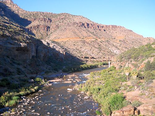
North Dakota's Theodore Roosevelt National Park ranked the highest of the 10  places in the United States that made the list. It came in at No.5 because  the former president did more than anyone to preserve this area, starting with a cattle ranch he founded in 1974. It's a good place to see badlands and, buffalo grazing on prairies. Remote, but well worth the trouble to get there.

No. 12 on the list is Park City, Utah, which is home to the United States' largest ski\resort at 7,300 acres when Park City Mountain Resort merged with nearby Canyons ski resort. The mega resort is known as Park City; the two resorts are linked by an eight-passenger gondola.

It may surprise some that Grand Rapids, Michigan, is on the list. It is, after all, famous for making furniture and Gerald Ford. But the Times chose it because of its dramatic transformation via urban renewal and its burgeoning art scene. Cornerstone of the revival is the Grand Rapids Downtown Market, 138,000 square feet devoted to food; the building itself was made of materials from the rundown buildings it replaced.  The city also is famous for ArtPrize, an annual competition of contemporary art that awards a half-million dollars in prizes. Not to be missed is the Frederik Meijer Garden & Sculpture part, which features work by famous artists, such as Rodin. Grand Rapids ranked 20th on the list.

No. 26 Washington, D.C., is already filled with historic monuments and museums. with the Times picking it this year before of a new museum opening in the fall. The Smithsonian, already famous for its outstanding collection of museums, is adding the National Museum of African American Museum this fall.

The Times calls Providence, Rhode Island, the East Coast's answer to Portland, Oregon. It's got famous new restaurants and the Creative Mile that is lined with sculptures that end in a new development that includes a riverfront park. It ranked No. 33 on the list.

East Bay, California, ranked No. 39 on  the list because of its fast-growing population as well as its fast-growing arts and food scene.  In Oakland, one of the East Bay communities, more than 300 restaurants and a dozen wineries have opened in recent years. Be sure to check out Spirits Alley where old Navy air hangers have been turned into breweries and wineries.

Most people have probably never heard of Rosine, Kentucky, No. 42; after all, it's only got 113 residents. It is, however, famous as the birthplace of bluegrass music. Jam sessions are held every Friday from March to December in an old barn that is a national landmark because it's said to be the place where bluegrass was invented by Bill Monroe. The small community hosts an annual bluegrass festival.

No. 46, St. Louis, Missouri, will open the National Blues Museum later this spring, the times noted, focusing on this music as the foundation for other music genres in this country. The city also is focusing on making its famous arch more accessible to the public in a major project that refreshes parks and promenades in the area.

Like the rest of Texas, Marfa, No. 48, does things in a big way. Take for instance, the Chinati Foundation, which showcases gigantic works of art by contemporary artists. To be unveiled this year is a 10,000-square piece by Robert Irwin. Other cultural events include music and film festivals.

Last on the list is scenic Beaufort, South Carolina, made the list because of its many amenities that range from restaurants and galleries to bike trials and benches overlooking the water. It also is noted for the reopening of a 250-year-0ld house, the Anchorage 1770, that in the 19th century was home to a literary club that focused on drinking, dancing and gambling.

Thursday, January 7, 2016

Good eatin' in Yuma, Arizona

Everyone gets hungry when they’re traveling. Eating new foods is part of the enjoyment of a trip. Even when you’re traveling in your own home, as we did for two years in our travel trailer, cooking in a tiny kitchen can be frustrating.

We spent seven months in Yuma, Arizona, and here’s a list of some of the restaurants we ate at frequently:

Martha's Gardens makes great milk shakes from
 dates grown in the on-site orchard.
·       Yuma Palace, 350 East 32nd Street, is the Asian restaurant that we ate at the most when we were in the mood for Chinese. Good food, good service, reasonable prices.

·       Lim’s Grand Buffet, 2135 East 16th Street, is a Chinese restaurant that is very popular with Yumans, with lines that frequently stretched out the door at meal times. They serve a wide variety of Chinese dishes, plus French fries, pizza and the best enchiladas I ate in Yuma. They offer a senior discount.

·       Da Boyz, 11274 South Fortuna Road, loads their pizzas with cheese and other goodies.  They frequently offer discount coupons on local shoppers.

·       Pita Pit, located in the Yuma Palms Mall, offers healthy pita sandwiches with a variety of fillings.

·       Martha’s Gardens can be hard to find, tucked away in rural Yuma at 9747 South Avenue 9-3/4 E, but their date shakes make it worth the trouble.  These milk shakes, made from medjool dates grown on their organic farm, are simply the best.  There’s almost always a line of people waiting for one. The snack bar also makes some pretty good sub sandwiches, too. The snack bar accepts only cash, while the store accepts debit and credit cards for other purchases. Martha’s is closed from late spring through early fall.